Marine Charting & Cartography
-
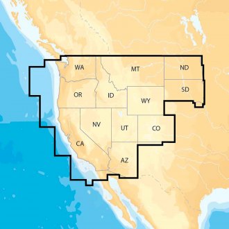
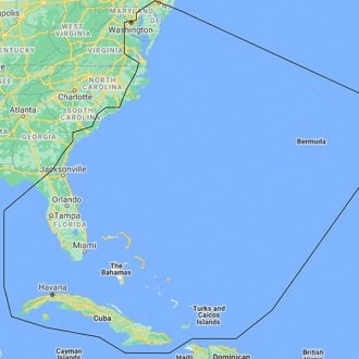
 Navionics® - Navionics+ US West Electronic ChartNavionics+ US West Electronic Chart by Navionics®. Navionics+ Regions is a powerfull chart solution providing more regional marine and lakes content than any other product on the market! Get derailed Nautical Chart, SonarChart™ 1' HD...Marine and lake chartsOne foot contours$92.49 - $169.16Availability Varies - Depends on Product Options
 - C-MAP® - Discover North America microSD Format Bathymetric Electronic Chart (M-NA-Y200-MS)Discover North America microSD Format Bathymetric Electronic Chart by C-MAP®. DISCOVER all you need to make the most of your time on the water. Full-featured Vector Charts with High-Res Bathy, including integrated Genesis® social data,...Full Featured Vector ChartsTides & Currents$134.89In Stock - Ships within 24 hrs
- C-MAP® - Reveal Coastal Alaska microSD Format Bathymetric Electronic Chart (M-NA-Y208-MS)Reveal Coastal Alaska microSD Format Bathymetric Electronic Chart by C-MAP®. Perfect for fishing and diving enthusiasts, C-MAP Reveal charts deliver ultra, high-resolution images of structure, wrecks, isolated reefs and ledges on the...High-definition C-MAP Reveal layer on selected areasReduces search time with immediate high-definition display of bottom structure, wrecks, isolated reefs and ledges$269.89In Stock - Ships in 24 to 48 hrs
- C-MAP® - Reveal Coastal British Columbia and Puget Sound microSD Format Bathymetric Electronic Chart (M-NA-Y207-MS)Reveal Coastal British Columbia and Puget Sound microSD Format Bathymetric Electronic Chart by C-MAP®. Perfect for fishing and diving enthusiasts, C-MAP Reveal charts deliver ultra, high-resolution images of structure, wrecks, isolated...High-definition C-MAP Reveal layer on selected areasReduces search time with immediate high-definition display of bottom structure, wrecks, isolated reefs and ledges$269.89In Stock - Ships in 24 to 48 hrs
- C-MAP® - Reveal Coastal Central America and the Caribbean microSD Format Bathymetric Electronic Chart (M-NA-Y205-MS)Reveal Coastal Central America and the Caribbean microSD Format Bathymetric Electronic Chart by C-MAP®. Perfect for fishing and diving enthusiasts, C-MAP Reveal charts deliver ultra, high-resolution images of structure, wrecks, isolated...High-definition C-MAP Reveal layer on selected areasReduces search time with immediate high-definition display of bottom structure, wrecks, isolated reefs and ledges$269.89In Stock - Ships in 24 to 48 hrs
- C-MAP® - Reveal Coastal Chesapeake Bay to the Bahamas microSD Format Bathymetric Electronic Chart (M-NA-Y203-MS)Reveal Coastal Chesapeake Bay to the Bahamas microSD Format Bathymetric Electronic Chart by C-MAP®. Perfect for fishing and diving enthusiasts, C-MAP Reveal charts deliver ultra, high-resolution images of structure, wrecks, isolated...High-definition C-MAP Reveal layer on selected areasReduces search time with immediate high-definition display of bottom structure, wrecks, isolated reefs and ledges$269.89In Stock - Ships within 24 hrs
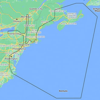
- C-MAP® - Reveal Coastal Great Lakes to Nova Scotia microSD Format Bathymetric Electronic Chart (M-NA-Y201-MS)Reveal Coastal Great Lakes to Nova Scotia microSD Format Bathymetric Electronic Chart by C-MAP®. Perfect for fishing and diving enthusiasts, C-MAP Reveal charts deliver ultra, high-resolution images of structure, wrecks, isolated reefs...High-definition C-MAP Reveal layer on selected areasReduces search time with immediate high-definition display of bottom structure, wrecks, isolated reefs and ledges$269.89In Stock - Ships within 24 hrs
- C-MAP® - Reveal Coastal Gulf of Mexico and the Bahamas microSD Format Bathymetric Electronic Chart (M-NA-Y204-MS)Reveal Coastal Gulf of Mexico and the Bahamas microSD Format Bathymetric Electronic Chart by C-MAP®. Perfect for fishing and diving enthusiasts, C-MAP Reveal charts deliver ultra, high-resolution images of structure, wrecks, isolated...High-definition C-MAP Reveal layer on selected areasReduces search time with immediate high-definition display of bottom structure, wrecks, isolated reefs and ledges$269.89In Stock - Ships within 24 hrs
- C-MAP® - Reveal Coastal Hawaii, Marshall Islands and French Polynesia microSD Format Bathymetric Electronic Chart (M-NA-Y210-MS)Reveal Coastal Hawaii, Marshall Islands and French Polynesia microSD Format Bathymetric Electronic Chart by C-MAP®. Perfect for fishing and diving enthusiasts, C-MAP Reveal charts deliver ultra, high-resolution images of structure,...High-definition C-MAP Reveal layer on selected areasReduces search time with immediate high-definition display of bottom structure, wrecks, isolated reefs and ledges$269.89In Stock - Ships within 24 hrs
- C-MAP® - Reveal Coastal Nova Scotia to Chesapeake Bay microSD Format Bathymetric Electronic Chart (M-NA-Y202-MS)Reveal Coastal Nova Scotia to Chesapeake Bay microSD Format Bathymetric Electronic Chart by C-MAP®. Perfect for fishing and diving enthusiasts, C-MAP Reveal charts deliver ultra, high-resolution images of structure, wrecks, isolated...High-definition C-MAP Reveal layer on selected areasReduces search time with immediate high-definition display of bottom structure, wrecks, isolated reefs and ledges$269.89In Stock - Ships within 24 hrs
- C-MAP® - Reveal Coastal US West Coast and Baja microSD Format Bathymetric Electronic Chart (M-NA-Y206-MS)Reveal Coastal US West Coast and Baja microSD Format Bathymetric Electronic Chart by C-MAP®. Perfect for fishing and diving enthusiasts, C-MAP Reveal charts deliver ultra, high-resolution images of structure, wrecks, isolated reefs and...High-definition C-MAP Reveal layer on selected areasReduces search time with immediate high-definition display of bottom structure, wrecks, isolated reefs and ledges$269.89In Stock - Ships within 24 hrs
- C-MAP® - Reveal Inland North Central US Lakes microSD Format Bathymetric Electronic Chart (M-NA-Y212-MS)Reveal Inland North Central US Lakes microSD Format Bathymetric Electronic Chart by C-MAP®. Perfect for fishing and diving enthusiasts, C-MAP Reveal charts deliver ultra, high-resolution images of structure, wrecks, isolated reefs and...High-definition C-MAP Reveal layer on selected areasReduces search time with immediate high-definition display of bottom structure, wrecks, isolated reefs and ledges$183.49In Stock - Ships in 24 to 48 hrs
- C-MAP® - Reveal Inland North East US Lakes microSD Format Bathymetric Electronic Chart (M-NA-Y213-MS)Reveal Inland North East US Lakes microSD Format Bathymetric Electronic Chart by C-MAP®. Perfect for fishing and diving enthusiasts, C-MAP Reveal charts deliver ultra, high-resolution images of structure, wrecks, isolated reefs and...High-definition C-MAP Reveal layer on selected areasReduces search time with immediate high-definition display of bottom structure, wrecks, isolated reefs and ledges$183.49In Stock - Ships within 24 hrs
- C-MAP® - Reveal Inland South Central US Lakes microSD Format Bathymetric Electronic Chart (M-NA-Y215-MS)Reveal Inland South Central US Lakes microSD Format Bathymetric Electronic Chart by C-MAP®. Perfect for fishing and diving enthusiasts, C-MAP Reveal charts deliver ultra, high-resolution images of structure, wrecks, isolated reefs and...High-definition C-MAP Reveal layer on selected areasReduces search time with immediate high-definition display of bottom structure, wrecks, isolated reefs and ledges$183.49In Stock - Ships in 24 to 48 hrs
- C-MAP® - 4D Central America and the Caribbean microSD Format Electronic Chart (M-NA-D065-MS)4D Central America and the Caribbean microSD Format Electronic Chart by C-MAP®. C-MAP 4D is the latest evolution of electronic charting technology, combining award-winning vector chart data with exclusive Dynamic Raster Charts and the...Full Featured Vector Charts: Provides a wealth of chart detail with the versatility to customize data layers and how they are viewedDynamic Raster: Traditional "paper chart" look with unique ability to access information on buoys, lights and other details$366.12In Stock - Ships within 24 hrs
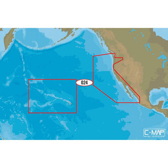
- C-MAP® - 4D US West Coast and Hawaii microSD Format Electronic Chart (M-NA-D024-MS)4D US West Coast and Hawaii microSD Format Electronic Chart by C-MAP®. C-MAP 4D is the latest evolution of electronic charting technology, combining award-winning vector chart data with exclusive Dynamic Raster Charts and the ability to...Full Featured Vector Charts: Provides a wealth of chart detail with the versatility to customize data layers and how they are viewedDynamic Raster: Traditional "paper chart" look with unique ability to access information on buoys, lights and other details$366.12In Stock - Ships within 24 hrs
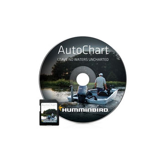
- Humminbird® - AutoChart™ North America DVD Format Software (600031-1)AutoChart™ North America DVD Format Software by Humminbird®. AutoChart: Map coverage where you make it. New Humminbird® AutoChart™ for North America (excluding Alaska) uses proprietary software that takes your Humminbird's sonar...Engineered to high standardsHigh-grade design delivers extended lifespan$144.99In Stock - Ships within 24 hrs
- Humminbird® - AutoChart™ Pro North America DVD Format Software (600032-1)AutoChart™ Pro North America DVD Format Software by Humminbird®. AutoChart PRO: Add another layer of detail to your cartography. New Humminbird® AutoChart PRO™ for North America (excluding Alaska) offers all the leading features...United States - Over 140,000 named water bodies and over 1.75 million unnamed water bodiesCanada - Over 96,000 named water bodies and over 3.85 million unnamed water bodies$181.25In Stock - Ships within 24 hrs
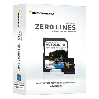
- Humminbird® - AutoChart™ Zero Line North America SD-Card Format Electronic Chart (600033-1)AutoChart™ Zero Line North America SD-Card Format Electronic Chart by Humminbird®. Zero Lines Map Card: The starting point to your mapping adventure. Please note this card is included with purchase of AutoChart or AutoChart PRO. The...32 GB SD card containing zero lines for with over 140,000 named water bodies and over 1.75 million unnamed water bodies in the United States and over 96,000 named water bodies and over 3.85 million unnamed water bodies in CanadaPlus there is 16 GB of free space to maintain your custom maps$72.47In Stock - Ships within 24 hrs
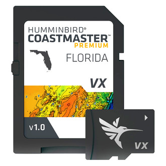
- Humminbird® - CoastMaster™ Florida V1 microSD Format Electronic Chart (602014-1)CoastMaster™ Florida V1 microSD Format Electronic Chart by Humminbird®. Find the path to your next big catch with the incredible accuracy and detail of Humminbird® CoastMaster® Premium, Florida providing highly accurate chart...2D Shaded Relief layer helps make bottom detail and depth changes easy to spotNavigate confidently with the help of enhanced Aerial Imagery$359.99In Stock - Ships in 24 to 48 hrs
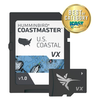
- Humminbird® - CoastMaster™ US Coastal V1 microSD Format Electronic Chart (601015-1)CoastMaster™ US Coastal V1 microSD Format Electronic Chart by Humminbird®. Find the path to your next big catch with the incredible accuracy and detail of Humminbird® CoastMaster™, providing highly accurate chart coverage for all...VX Technology provides five customizable color palettes and faster map load times, so you can seize every moment on the waterSee the world your way with three preset views. It’s quick and easy to switch from fishing charts to nautical charts, or to create your own custom view settings$179.99In Stock - Ships within 24 hrs
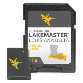
- Humminbird® - LakeMaster™ Louisiana Delta microSD Format Electronic Chart (600050-1)LakeMaster™ Louisiana Delta microSD Format Electronic Chart by Humminbird®. Humminbird LakeMaster now offers high resolution aerial photography of the Louisiana Delta on one micro card (with SD adaptor). Coverage and Compatibility...View all the hidden features of the Louisiana Delta with real life aerial views of shorelines, waterways, landmarks, obstructions, roads, marinas, canals, and channelsAlso includes nav aids, lake names, points of interest and more$179.99In Stock - Ships within 24 hrs
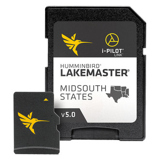
- Humminbird® - LakeMaster™ Midsouth States V5 microSD Format Electronic Chart (600009-9)LakeMaster™ Midsouth States V5 microSD Format Electronic Chart by Humminbird®. The Humminbird LakeMaster Mid-South Edition, Version 5, has added over 65 new lakes since the prior version – 60+ in High Definition. In all, this...LakeMaster micro SD card with adapter includes depth contour information and features such as Depth Highlight, Shallow Water Highlight and Water Level Offset, which can be used exclusively with Humminbird fish findersNew High-Definition lake map data available for the following lakes: Brady Branch Reservoir, Caddo, DeQueen (AR), Eufaula (OK), Grand Lake of the Cherokees, Livingston, Nacodgoches, Norfork, Robert S Kerr, Skiatook, Tawakoni and more$179.99In Stock - Ships within 24 hrs
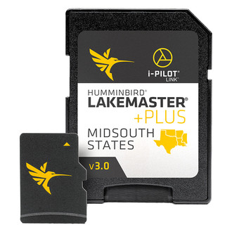
- Humminbird® - LakeMaster™ Plus Midsouth States V3 microSD Format Electronic Chart (600009-8)LakeMaster™ Plus Midsouth States V3 microSD Format Electronic Chart by Humminbird®. The Humminbird LakeMaster PLUS MidSouth Edition, Version 3, has added over 65 new lakes since the prior version – 60+ in High Definition....LakeMaster PLUS series includes all contour data, depth highlight and water level offset features found on a LakeMaster card, PLUS it allows for aerial image overlay on High-Definition waters. This gives you the ability to use quality aerial photography to view the entry and exits of creek channels, see how far a reef or weed line extends, and pick out shallow water rock piles, steep drop-offs or other features of the lake you've been missing from traditional mapsNew High-Definition lake map data available for the following lakes: Brady Branch Reservoir, Caddo, DeQueen (AR), Eufaula (OK), Grand Lake of the Cherokees, Livingston, Nacodgoches, Norfork, Robert S Kerr, Skiatook, Tawakoni and more$239.99In Stock - Ships within 24 hrs
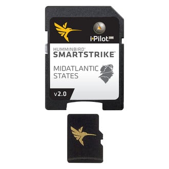
- Humminbird® - SmartStrike™ Mid Atlantic microSD Format Electronic Chart (600047-2)SmartStrike™ Mid Atlantic microSD Format Electronic Chart by Humminbird®. The Humminbird SmartStrike MidAtlantic States Edition, Version 2 Map Card features many FRESHWATER lakes in Delaware, Maryland, North Carolina, South Carolina,...i-Pilot® Link™ compatibleEasy to read contours$239.99In Stock - Ships within 24 hrs
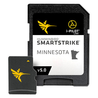
- Humminbird® - SmartStrike™ Minnesota V5 microSD Format Electronic Chart (600038-5)SmartStrike™ Minnesota V5 microSD Format Electronic Chart by Humminbird®. The Humminbird SmartStrike Minnesota Edition, Version 5 boasts more than 700 High Definition lakes overall and more than 3,325 total lakes from MN. This card...SmartStrike provides LakeMaster depth contours and includes features such as Depth Highlight, Shallow Water Highlight and Water Level Offset, while also providing predictive fish information based on your specific conditionsSmartStrike takes you straight to the action by showing you where the fish should be biting on any of the High Definition lakes of your choice. Based on search parameters like season, time of day, temperature and targeted fish species, SmartStrike highlights areas of the lake map where your prey is most likely to be located - before you even wet a line$239.99In Stock - Ships within 24 hrs
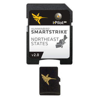
- Humminbird® - SmartStrike™ NorthEast V2 microSD Format Electronic Chart (600048-2)SmartStrike™ NorthEast V2 microSD Format Electronic Chart by Humminbird®. The SmartStrike NorthEast Edition, Version 2 micro map card has added over 200 new lakes, 27 High Definition - Surveyed waters to now boast contours for a total...i-Pilot® Link™ compatibleEasy to read contours$239.99In Stock - Ships within 24 hrs
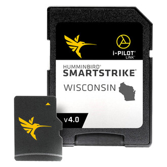
- Humminbird® - SmartStrike™ Wisconsin V4 microSD Format Electronic Chart (600041-4)SmartStrike™ Wisconsin V4 microSD Format Electronic Chart by Humminbird®. The Humminbird SmartStrike Wisconsin, Version 4 combines many of the best fishing waters in throughout the state all on one map card. SmartStrike is a family of...Engineered to high standardsHigh-grade design delivers extended lifespan$239.99In Stock - Ships in 24 to 48 hrs
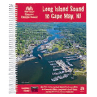
- Maptech® - Long Island Sound to Cape May V15 Guide (CGLIS-15)Long Island Sound to Cape May V15 Guide by Maptech®. 15-th Edition. New York Harbor to Block Island, Long Island's South Shore, the Hudson River, and New Jersey's coast from Raritan Bay to Cape May. Packed with detailed listings for...Engineered to high standardsHigh-grade design delivers extended lifespan$38.76In Stock - Ships in 24 to 48 hrs
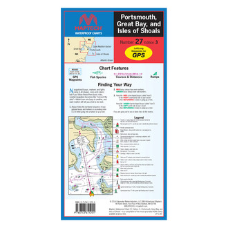
- Maptech® - Portsmouth Great Bay and Isles of Shoals V3 Waterproof Chart (WPC027-03)Portsmouth Great Bay and Isles of Shoals V3 Waterproof Chart by Maptech®. 3-rd Edition. Great Bay and Piscataqua River to Isles of Shoals. Featuring GPS Waypoints, courses and distances, ramp locations, state parks, and fishing areas....User-Friendly, Flip-Fold FormatKey Symbols and Finding Your Way Tips$20.22In Stock - Ships in 24 to 48 hrs


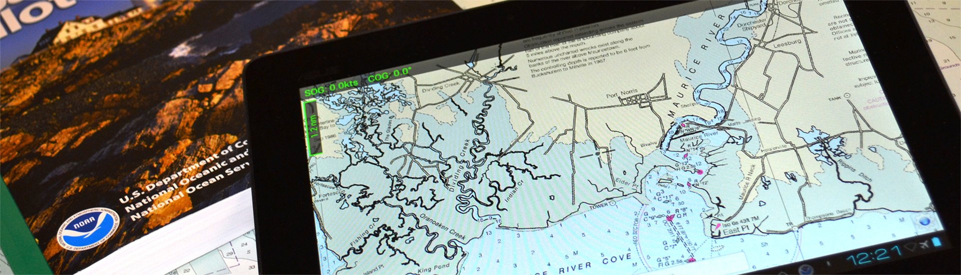
A safe boating experience cannot be imagined without nautical maps. Though conventional paper marine maps are still used on every boat, new technologically-advanced electronic charts have made the entire map reading and course planning routine much easier. So what is electronic cartography? The definition is pretty straightforward - electronic charts are digital versions of the most dependable government-issued paper charts and maps crated to simplify your navigation.
The data that is used by electronic charts comes from a number of government sources including NOAA, Canadian Hydrographics, and many others. Electronic charts give mariners greater possibilities on the water, providing you with innovative object-oriented cartography. Normally the electronic charts are displayed on chartplotters, multifunction displays (smartphones) or personal computers. Chartplotters, that are typically waterproof, are usually opted for when you own smaller 40’-50’ boats, while tablets and smartphones are well-suited for larger sail and power boats. PCs are usually used on large vessels and commercial boats.
Electronic charts are available in a number of formats: dynamic raster scanned charts (Maptech) that are basically direct video images of paper charts. They are precise and reliable versions of conventional paper charts. Vector charts (Garmin, Navionics, C-Map) typically take less memory as they have the information transformed into coordinates in a data file. Vector charts are “object oriented”, so when a cursor is positioned over icons, numerals, words or other features, additional windows with detailed descriptions will pop up. New generation 3D maps with high-definition relief will provide you with improved underwater view.
Electronic charts for chartplotters are usually available on small microSD memory cards that can be inserted into a GPS unit. In their turn, smartphone and PC charts are downloadable. While the paper maps show signs of heavy use, over time signaling you to get a newer version, the electronic chart will look brand new, but may pose danger when outdated. Thus, your electronic maps should be regularly updated and kept current to provide greater level of protection against marine hazards. Either used for recreational and commercial boating or fishing, interactive electronic charts will help you make the most of your boating experience.